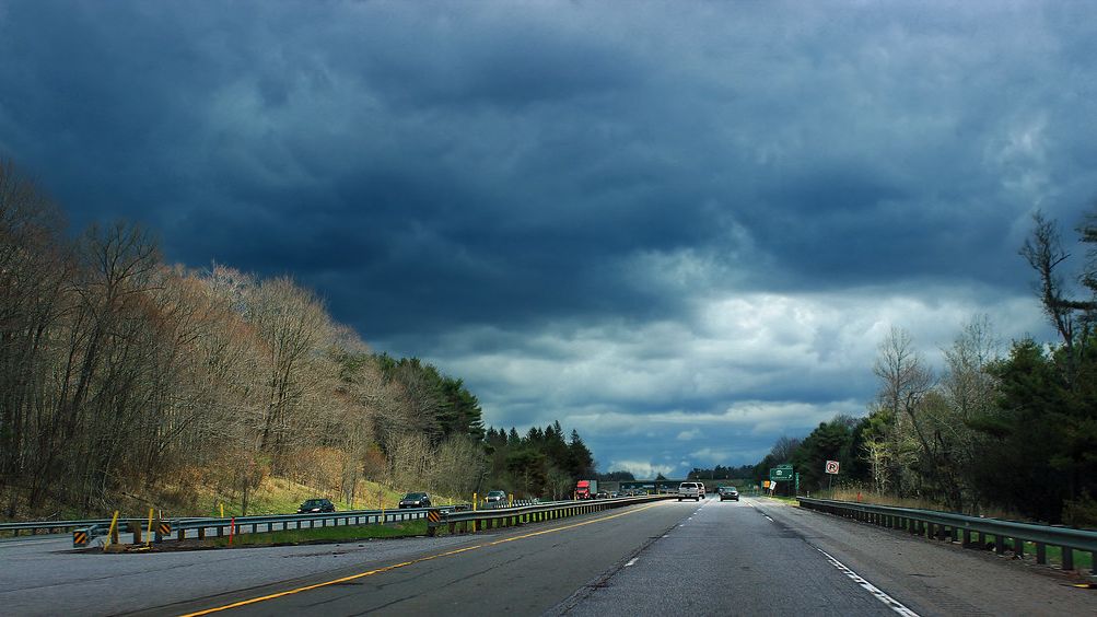

There’s a particular kind of quiet that settles over a truck cab at 3 a.m. somewhere between Laredo and Wichita. Just you, the hum of the engine, and an absolutely enormous sky. If you spend enough miles on the I-35 corridor, you start to think you understand weather. Then a year like the past couple comes along and reminds you, pretty bluntly, that you don’t.
The rules have quietly changed. The alerts are different. The storms are different. So when your phone screams at you on a Tuesday afternoon somewhere near Oklahoma City, it’s worth understanding why that warning sounds different from the ones that came before it. Let’s get into it.
The Corridor Itself Is One of the Most Storm-Exposed Stretches of Road in America
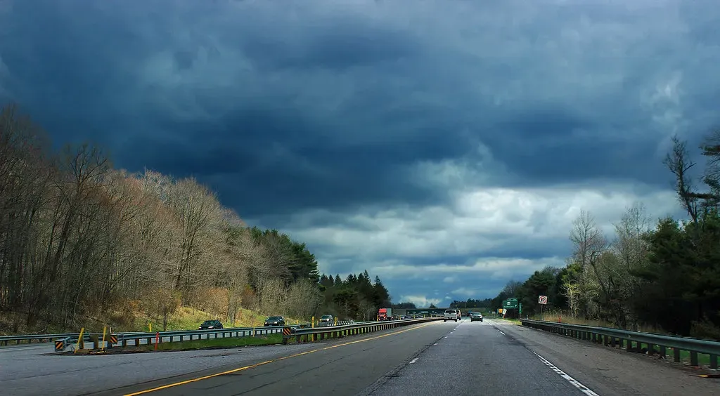
The I-35 corridor cuts a long, uninterrupted line straight through the heart of what meteorologists call Tornado Alley, running from Laredo, Texas all the way north through Oklahoma, Kansas, Missouri, Iowa, and into Minnesota. It’s not a highway that skirts around severe weather country. It drives directly through the middle of it, mile after mile.
This isn’t just a geographic curiosity. It means that professional drivers on this route are statistically exposed to some of the most intense convective storm environments on the planet, season after season. Think of it like commuting through the most lightning-prone intersection in your city, every single day, for years on end. The odds eventually catch up with you in some form or another.
2024 Was Not a Normal Tornado Season, Not Even Close

The severe weather that occurred across the U.S. in 2024 can be characterized as near historic, resulting in the second-highest number of tornadoes since record-keeping began in 1950, with 1,796 confirmed tornadoes, according to NOAA’s Storm Prediction Center. To put that in perspective, an average year sees roughly a thousand tornadoes nationally. 2024 blew well past that.
The near-record year was driven by a very active April and May and several tropical systems which produced tornadoes, with a well-above-average season in late December. There were 185 tropical cyclone tornadoes in 2024, and most notably, there were 6 EF3 tornadoes that exceeded the total EF3 count for the prior 29 years. That last part is genuinely jaw-dropping if you let it sink in. One year outpaced three decades of the most violent cyclone-spawned twisters on record.
I-35 States Were Ground Zero for the Most Violent Outbreaks
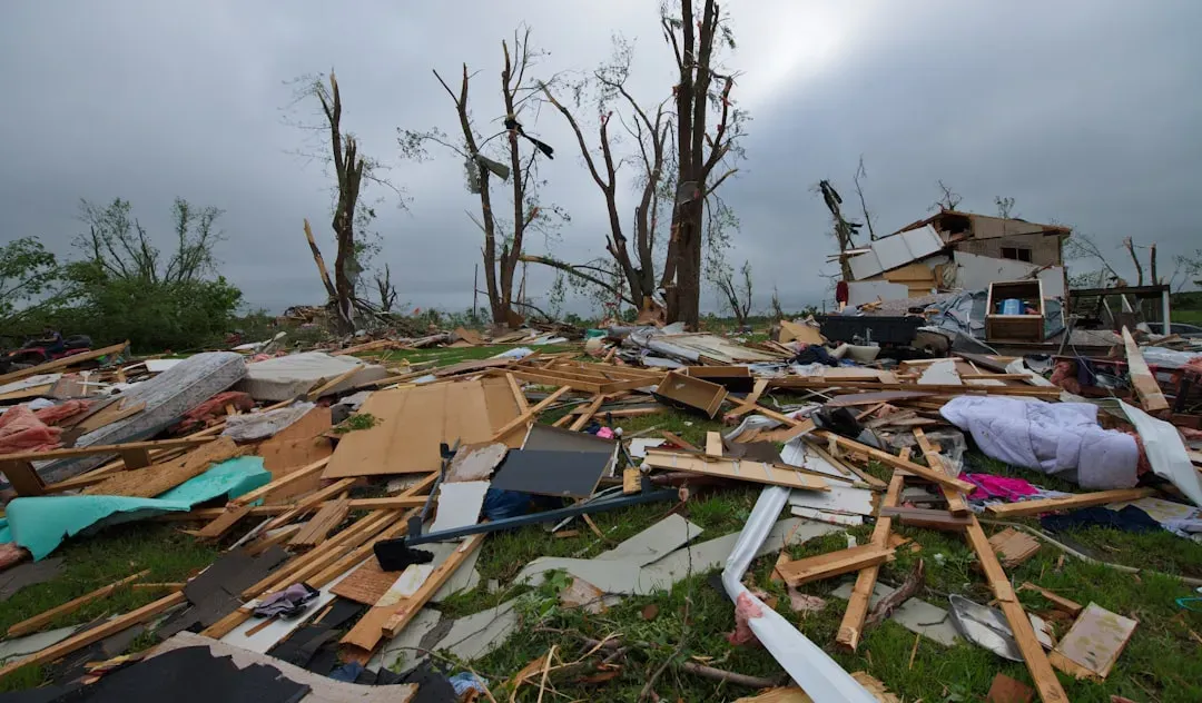
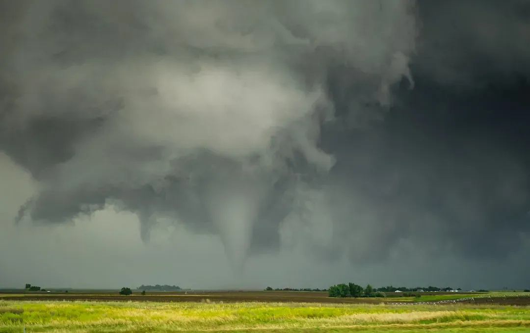
Four EF-4 tornadoes were confirmed during 2024, occurring in Elkhorn, Nebraska (April 26); Marietta, Oklahoma (April 27); Barnsdall, Oklahoma (May 6); and Greenfield, Iowa (May 21). Every single one of those locations sits either on or very close to the I-35 corridor. That’s not a coincidence. That’s a pattern.
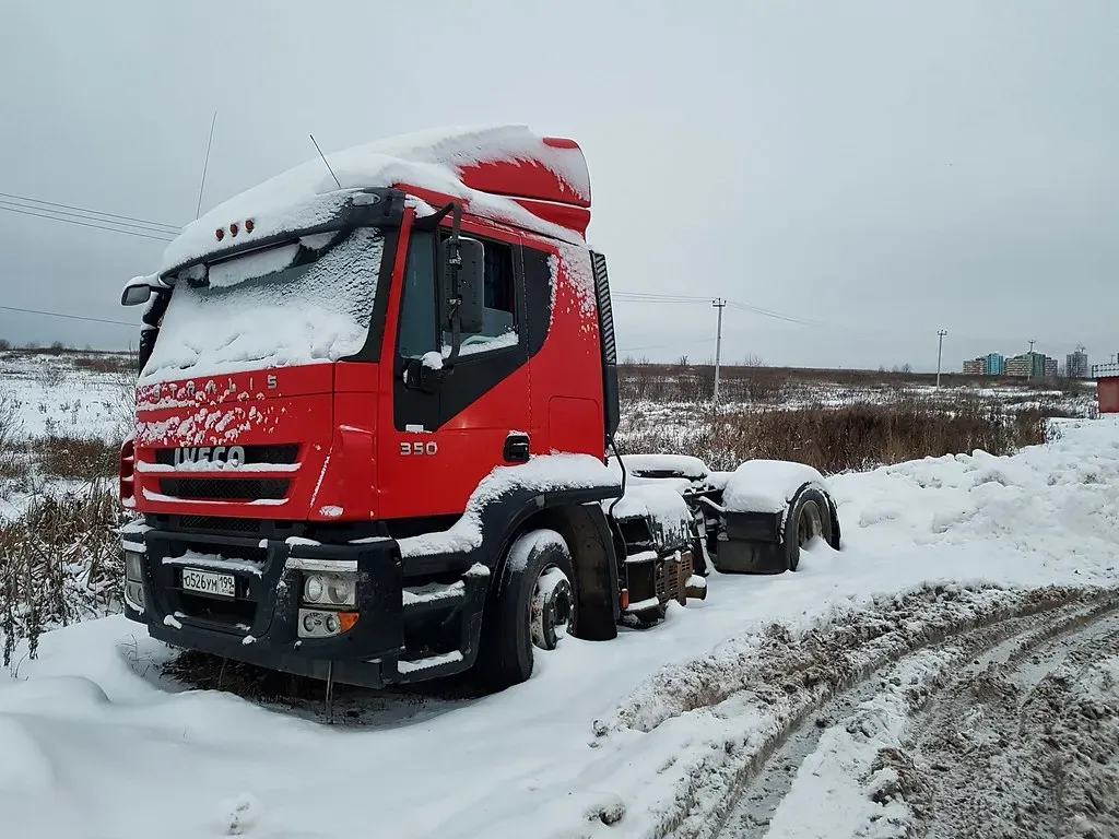
The strongest tornado of one major April outbreak was a violent, low-end EF4 tornado that moved through the western part of Marietta, killing a person on I-35 and destroying a large warehouse and a grocery store. The tornado crossed over I-35, overturning a semi-truck on the freeway. The driver of the truck was injured, while the passenger was killed. A gas station canopy at a truck stop was also damaged, and two tractor-trailers were tossed and stacked on top of each other. This is not abstract risk. This happened on the road, to people doing their jobs.
Hail Records Were Shattered, and That Matters Enormously for Drivers

In addition to the notable tornado season in 2024, several hail records were broken. May had the most significant hail reports for hailstones two inches or larger on record, with 470 reports. A new March largest hailstone record was set at 6 inches in Ada, Oklahoma on March 14, and a new May largest hailstone record of 6.12 inches was set in Johnson City, Texas on May 9.
Honestly, if you’ve never seen what baseball-sized hail does to a cab, it’s hard to explain. A windshield can go in seconds. A trailer roof can be compromised in ways that aren’t obvious until you’re already on the road again. There were 470 reports of hailstones being 2 inches or larger in 2024, completely surpassing the previous record of 316 reports set back in 2011. For commercial vehicle operators, that’s not just a weather stat. That’s an insurance claim, a blown delivery window, and possibly a serious safety incident.
The Warning Language You’re Seeing on Your Phone Has Actually Changed

Here’s the thing most drivers don’t realize: the words in today’s storm alerts are not the same words that were used a decade ago. The National Weather Service has moved to what’s called impact-based warnings, using specific, plain-language severity tags that didn’t exist in older systems. As of August 2, 2021, the NWS added Severe Thunderstorm Warnings labeled with a “destructive” damage threat, for wind gusts over 80 mph and hail over baseball size.
When you see the word “destructive” or “considerable” in a warning on a Tuesday afternoon, that’s not fluff. Those words are deliberate and tiered. They are tied to specific thresholds that trigger different alert protocols. The system is designed to cut through the noise and tell you, in plain terms, whether this is a storm you wait out under an overpass or a storm you need to have not been near in the first place.
Your Phone’s Emergency Alerts Are Now Frighteningly Precise

As of December 2019, participating wireless providers must geographically target alerts to technologically compatible phones, delivering alerts to the area specified by the alert originator with no more than a 1/10 of a mile overshoot. This “enhanced geotargeting” relies on new smartphone technology and is increasingly available as consumers upgrade their devices. Think about that. Half a city block of precision, pushed to your phone while you’re rolling down the highway at 65 mph.
CTIA, a U.S. wireless association, estimates that about 83 percent of consumers’ smartphones supported this enhancement in 2023, an increase from about 60 percent in 2022, 34 percent in 2021, and 18 percent in 2020. That growth curve is steep. It means the alert you receive today is far more likely to actually apply to your precise location than one you would have received just three or four years ago. For a driver moving through a warned zone in real time, that precision can be the difference between a close call and a catastrophe.
Climate Trends Are Shifting the Storm Environment Along the Corridor
Let’s be real: this part of the conversation makes some people uncomfortable. But the data isn’t political. It’s physical. Research from Climate Central has found that severe thunderstorm environments are increasing across the central United States, including the areas that sit directly along I-35. Following historically active storm seasons in prior years, activity in 2024 quickly increased to near-historic levels for about a month-long period, as a series of severe weather outbreaks in late April, early May, and mid-to-late May impacted portions of the Plains to the lower Ohio Valley.
The busy 2024 tornado season resulted in 6 new state tornado records, including Illinois, Iowa, New York, Ohio, Oklahoma, and West Virginia. Several of those states sit squarely on or near the I-35 corridor. It’s hard to look at that list and not notice the geographic clustering. The storm environment is not staying the same from year to year, and drivers who approach Tuesday alerts with 2015 assumptions are operating on outdated information.
Weather-Related Crashes Are a Massive and Underappreciated Risk on the Road
Out of nearly six million vehicular crashes that occur every year in the United States, approximately 21 percent are weather-related, according to the Federal Highway Administration. That’s roughly one in five crashes tied directly to conditions like rain, hail, high winds, and reduced visibility. Drivers who travel the I-35 corridor regularly are cycling through storm-prone regions during peak convective seasons every spring and summer.
Recent statistics show that approximately 21 percent of all vehicle crashes, nearly 1.2 million accidents annually, are directly attributed to hazardous weather conditions. These incidents result in approximately 5,900 deaths yearly, which is remarkably 15 times higher than the annual fatalities from natural disasters in the U.S. The highway, during a severe storm, is statistically one of the most dangerous places a person can be. And yet the default instinct for many drivers is to keep pushing through.
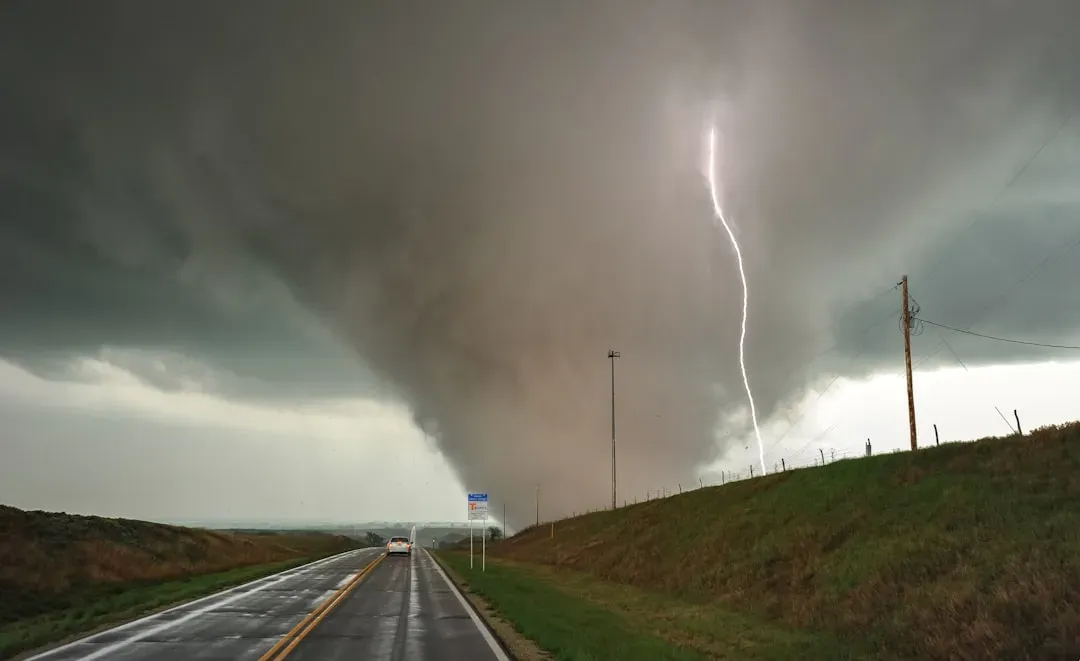
Tuesday Storms on the Plains Carry a Specific Danger Profile
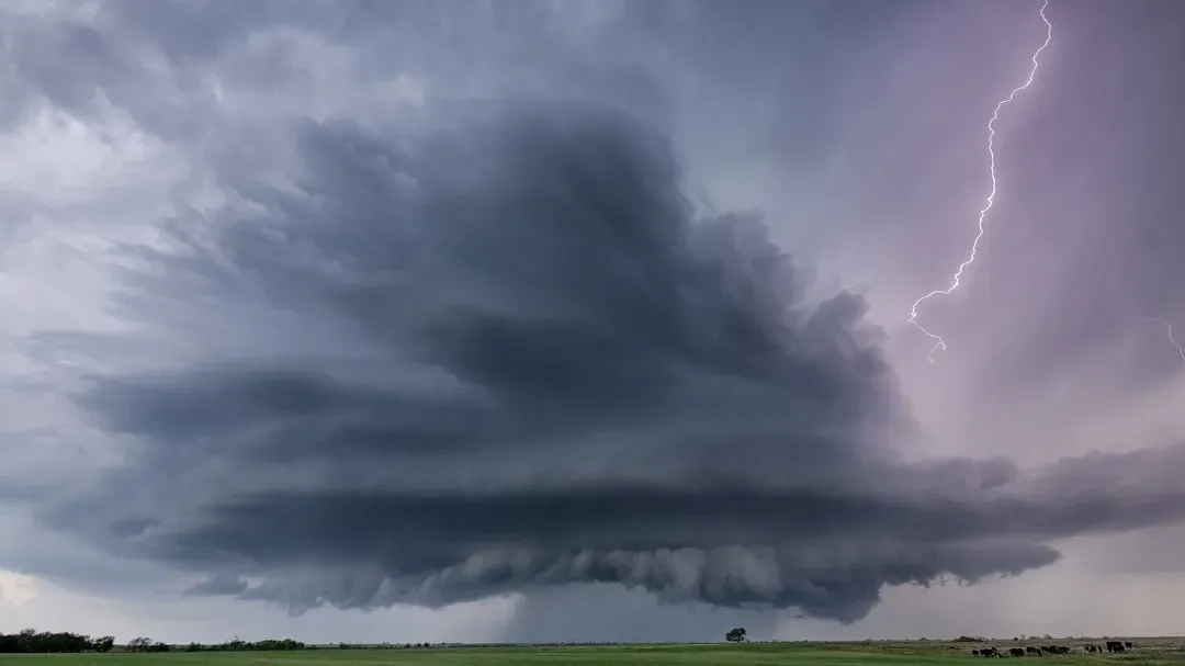
It’s hard to say for sure why Tuesdays specifically feel notable to experienced corridor drivers, but the underlying meteorological reality is straightforward. Severe storm outbreaks across the southern and central Plains tend to cluster around midweek patterns tied to jet stream positioning and moisture transport from the Gulf. The Storm Prediction Center predicted an enhanced risk of severe weather for parts of Kansas, Oklahoma, and Texas, highlighting the risk of tornadoes and large hail in connection with storms developing along a dry line between the Texas Panhandle and northwestern Kansas.
The dry line, which is that invisible boundary between hot, dry air pushing east from the Rockies and warm, moist Gulf air surging north, is essentially a storm factory when it becomes active. On the I-35 corridor, you will cross that line multiple times across a single long haul. A large-scale and destructive tornado outbreak in April 2024 saw strong tornadic activity erupting in Nebraska, Iowa, and Kansas as a broad upper trough moved eastward, with the Storm Prediction Center issuing an enhanced risk for the Plains. These are not fringe events anymore. They’re increasingly the baseline expectation.
What Has Actually Changed in How Drivers Should Respond
The old instinct, pull under an overpass, was not just wrong. It was deadly wrong. Modern emergency guidance from NOAA and FEMA is explicit: highway overpasses offer essentially no protection from a tornado and can actually funnel and accelerate winds. WEA 3.0 can support geographical targeting accuracy of 0.1 mile. That means when your phone screams at you, the warning may be talking about the exact half-mile stretch of highway you’re currently driving through.
WEAs have been a game changer in helping the National Weather Service get warnings to people quickly when they are located near a threat. If you travel into a threat area after an alert is first sent, your WEA-capable device will receive the message when you enter the area. For a driver moving at highway speed, that real-time geographic delivery is genuinely new. It means the alert system is now tracking the storm polygon and your movement simultaneously. The best response when you receive a destructive-level warning is to exit the highway, find a low-lying ditch away from trees and vehicles, and abandon the cab if the storm is imminent.
Conclusion: The Corridor Hasn’t Changed. Everything Around It Has.
The I-35 corridor is the same ribbon of asphalt it’s always been. But the storms forming along it, the frequency of the most violent events, the sophistication of the warning system reaching your phone, and the documented surge in tornado and hail activity across exactly the states this highway runs through: all of that has shifted in ways that matter deeply to anyone making their living behind the wheel.
2024 was the second-most active tornado year on record. Hail records fell across Oklahoma and Texas. Impact-based warning language is now embedded in the alerts you receive. And your phone’s precision in telling you exactly where the danger is has improved by leaps and bounds over just the past five years. Tuesday’s storm alert isn’t just another buzzing notification to scroll past.
Treating it differently isn’t overcaution. It’s the smartest thing a road-seasoned driver can do with everything we now know. What would it take for you to pull off the road the next time that alert sounds? Think about it before you need the answer.