The Surprising Power Beneath the New Madrid Seismic Zone
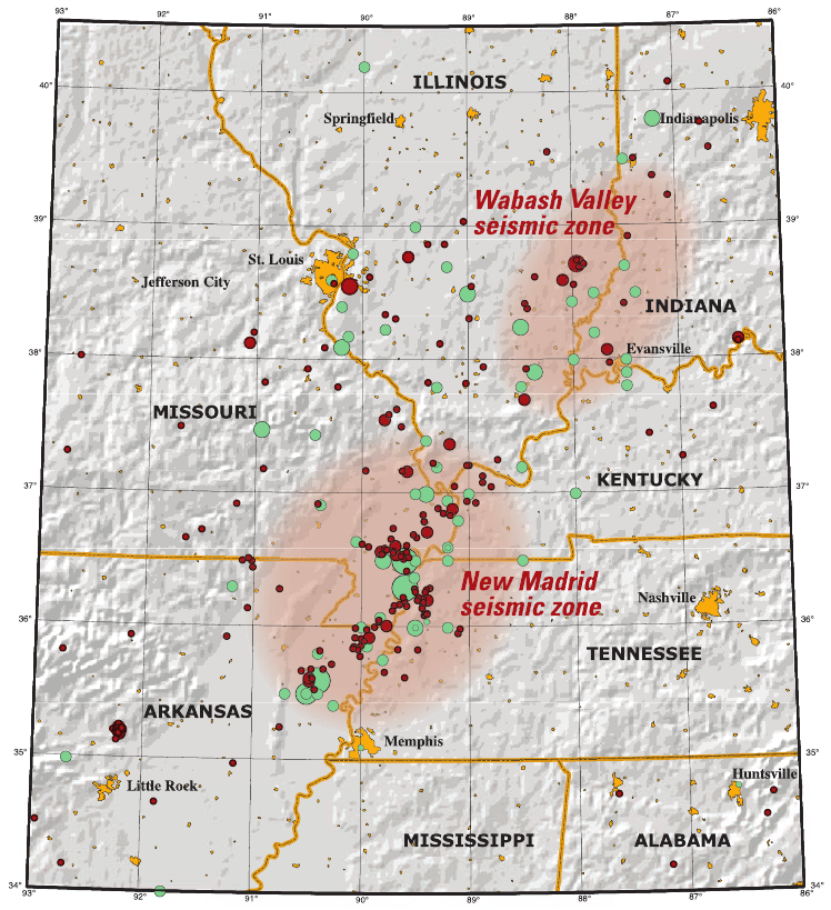
When people talk about earthquakes in the United States, most immediately picture California. But the New Madrid Seismic Zone, stretching across Missouri, Arkansas, Tennessee, and Kentucky, has a history that rivals the West Coast for sheer destructive power. In the winter of 1811-1812, a series of quakes here were so intense that they made the Mississippi River run backward for a short time. Scientists estimate those quakes reached magnitudes between 7.0 and 8.0. While California’s San Andreas Fault gets all the press, the New Madrid zone is still dangerously active. According to the U.S. Geological Survey, there’s a 7–10% chance of a major quake (magnitude 7 or greater) in this region within the next 50 years. Most locals don’t even realize they’re living atop one of North America’s most unpredictable seismic zones.
The Cascadia Subduction Zone: America’s Sleeping Giant
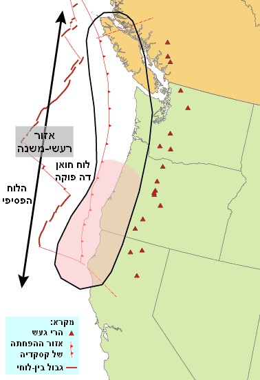
Tucked quietly off the Pacific Northwest coast, the Cascadia Subduction Zone hasn’t made headlines recently—but it should. This fault, spanning from Northern California to British Columbia, is a ticking clock. Geologists say it’s capable of producing megaquakes up to magnitude 9.0 or higher, along with devastating tsunamis. The last big event was in 1700, and researchers from Oregon State University have shown that the region is overdue for another. FEMA estimates a full rupture could cause over 10,000 deaths and leave millions without basic services for months. Despite this, many residents of Seattle, Portland, and coastal towns remain startlingly unaware of the risk lurking beneath their feet.
Why the New Madrid Zone Stands Out

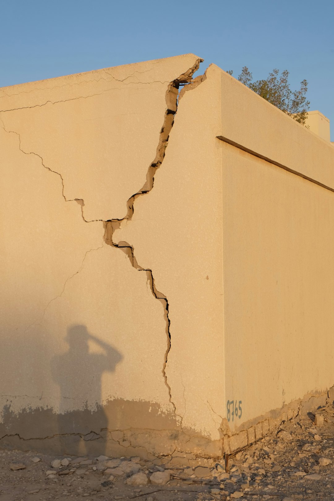
Unlike California’s faults, which are widely monitored and well-known, the New Madrid Seismic Zone lies in the heart of America, far from any tectonic plate boundary. Its quakes happen in the middle of the continent, so the shockwaves travel farther and impact a much wider area. The U.S. Geological Survey says that a major earthquake here could affect states as far as Illinois, Mississippi, and even Indiana. Most buildings in this region weren’t built with earthquakes in mind. In fact, a 2023 report from the Central U.S. Earthquake Consortium warned that millions of homes and schools are at risk of collapse. The last major quake happened over 200 years ago, but researchers say the ground is still shifting, and the next big one could come at any time.
Cascadia’s Tsunami Danger

One of the scariest things about the Cascadia Subduction Zone isn’t just its ground-shaking power—it’s the potential for a massive tsunami. In 2011, the world watched in horror as Japan’s Tohoku earthquake sent a wall of water crashing into coastal towns. Scientists say Cascadia could deliver a similar punch. Models from the National Oceanic and Atmospheric Administration show that a rupture would send a tsunami barreling toward Oregon and Washington’s coast within 15-30 minutes. That leaves almost no time for evacuation. New research in 2024 revealed that up to 100,000 people living in low-lying Pacific coast communities are in the direct path of this threat.
Recent Activity: A Wake-Up Call
While both zones have been quiet lately, recent tremors are raising eyebrows among experts. In April 2025, a cluster of small quakes struck near Blytheville, Arkansas, right in the New Madrid zone. Though none topped magnitude 4, they served as a reminder that the fault is still very much alive. Meanwhile, in December 2024, seismic sensors picked up a swarm of minor quakes off the Oregon coast—right above Cascadia. The Pacific Northwest Seismic Network reported over 50 tremors in less than a week. These aren’t signs of immediate disaster, but they show the faults are still accumulating stress.
How Prepared Are We? The Reality Check

Despite the risks, most communities above these fault lines are alarmingly underprepared. A 2025 survey by the American Red Cross found that only 27% of households in the Central U.S. had an earthquake emergency plan. In the Pacific Northwest, the figure was just slightly higher. Critical infrastructure—like bridges, hospitals, and schools—often isn’t built to withstand the kind of shaking a major quake could bring. Emergency managers in St. Louis and Memphis admit that mass evacuation plans are outdated or incomplete. In Oregon, less than half of the public schools meet modern seismic standards. Experts warn that a lack of awareness and preparation could multiply the devastation.
Historic Earthquakes: Lessons From the Past
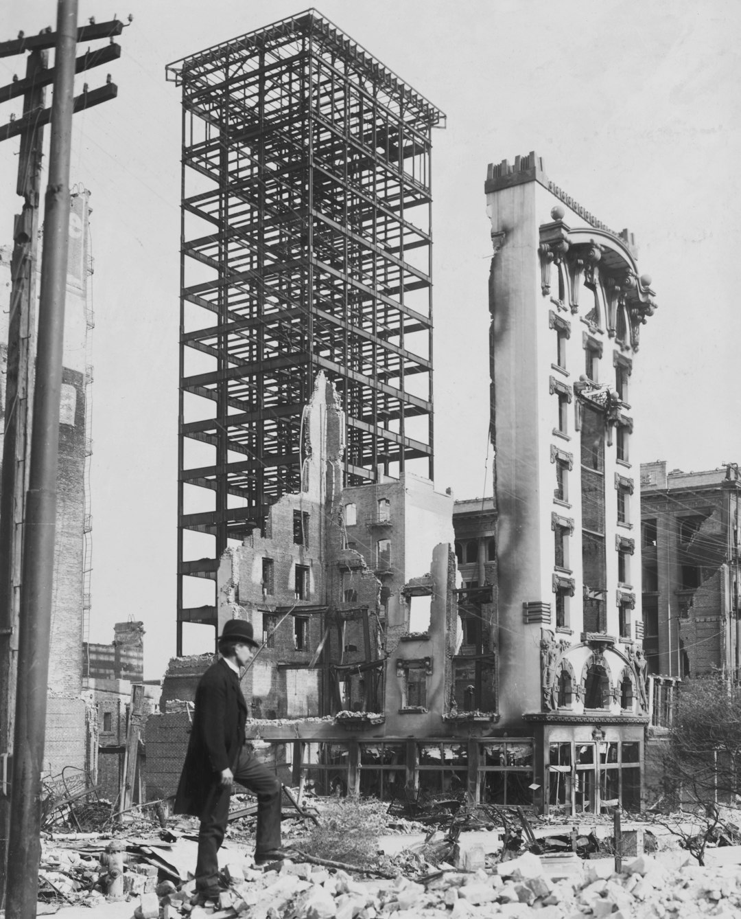
History offers chilling warnings. The New Madrid earthquakes of 1811-1812 remain the most powerful in U.S. history, felt as far away as Boston and Charleston. Eyewitnesses described the ground rolling “like waves on the sea.” In the Pacific Northwest, the 1700 Cascadia quake was so powerful it sent a tsunami all the way to Japan, where ancient records documented the arrival of “orphan waves.” Modern researchers have pieced together the evidence using tree rings and coastal marsh sediments. These historic disasters remind us that these faults are not dormant—they’re just waiting.
Population Growth and Urban Risk
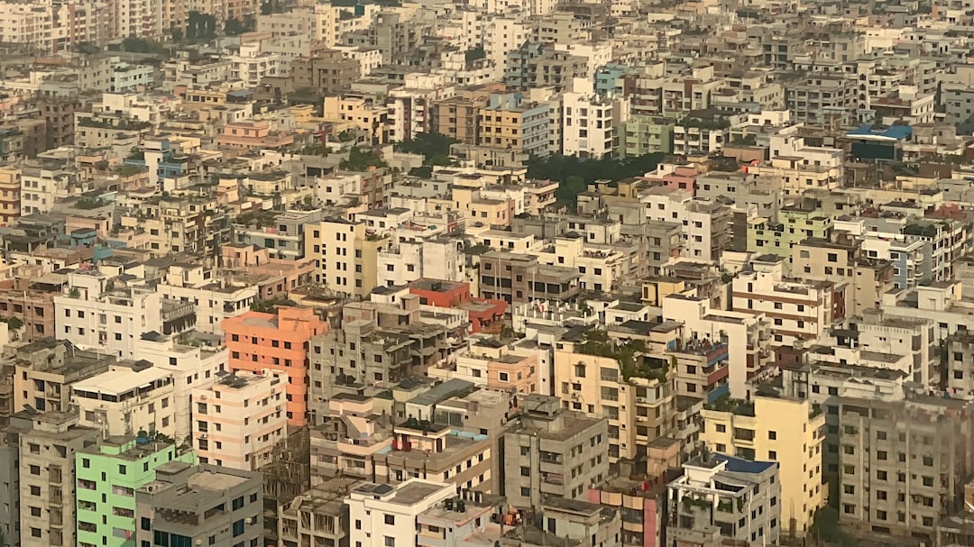
Both regions have grown dramatically since their last major quakes. Memphis, Nashville, and St. Louis now sit atop the New Madrid zone, with millions more people at risk than in the 1800s. The Pacific Northwest, including Seattle and Portland, has seen a boom in population and high-rise construction. According to the U.S. Census Bureau, over 10 million people now live in areas that could experience severe shaking from Cascadia. With denser populations and more complex infrastructure, the potential for loss—both human and economic—is far greater than ever before.
Infrastructure Vulnerabilities Exposed
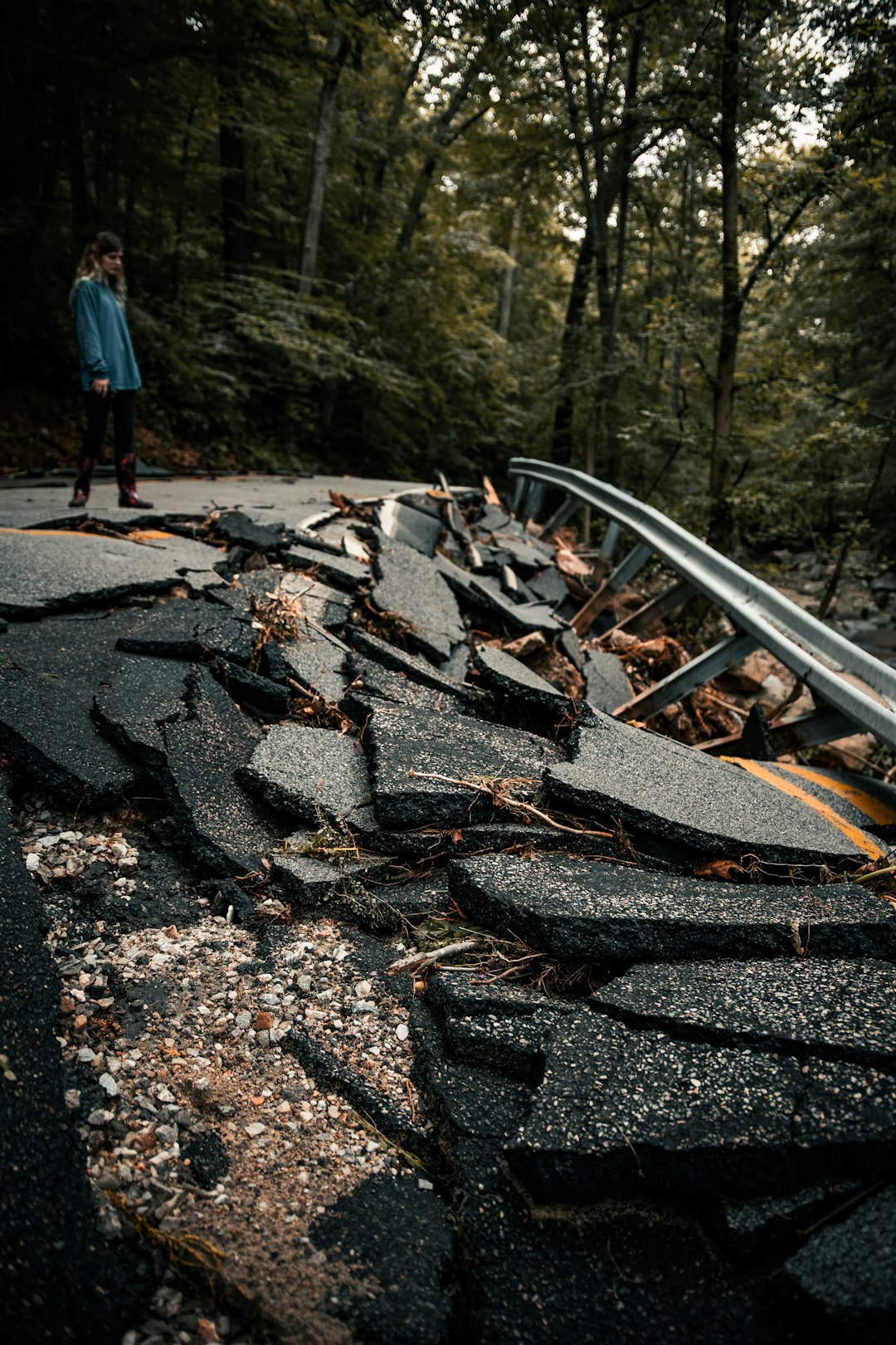
A 2024 engineering assessment by the American Society of Civil Engineers found that over 75% of bridges and highways in the New Madrid region are “functionally obsolete” for a major earthquake. Hospitals and emergency response centers could be cut off for days or weeks. In Seattle and Portland, many older buildings are made of unreinforced masonry, which can crumble in seconds during a quake. Water mains, gas lines, and power grids haven’t been fully retrofitted, meaning even a moderate quake could leave millions without basic services. The financial impact could run into the hundreds of billions, according to recent FEMA projections.
What Scientists Are Doing Now
Researchers are racing to understand these faults before disaster strikes. The U.S. Geological Survey has expanded its network of seismic sensors across both regions, hoping to provide earlier warnings. In 2025, a new deep-earth imaging project in the New Madrid zone revealed previously unknown fault branches, increasing the urgency for preparedness. In Cascadia, ocean-bottom sensors are now being used to track subtle shifts in the seafloor. Scientists hope that with better monitoring, they can spot the warning signs of a big quake in time to give people precious extra seconds to take cover.
Community Action and the Way Forward

Some communities are beginning to take the threat seriously. Memphis launched a public safety campaign in early 2025, urging residents to secure heavy furniture and create emergency kits. In Oregon, new state laws require that all new schools and hospitals be built to withstand a Cascadia megaquake. Local governments are updating building codes and running earthquake drills. While progress is slow, the hope is that these steps can reduce casualties and speed recovery when—not if—the next big quake hits.
End.