Iconic drives hug the edges of America’s coasts, offering stunning views of ocean waves crashing against rugged cliffs or sandy shores. These routes draw millions each year for their raw beauty and sense of escape. Yet rising seas and relentless erosion are gnawing away at the land beneath them, with recent storms and landslides serving as stark warnings.[1][2]
Projections show sea levels climbing enough by the mid-2030s to amplify flooding along nearly all U.S. coastlines, hitting roads hardest where the margin for error is slim. Closures have multiplied in recent years, from California to the Carolinas, as repairs chase an accelerating problem. Without drastic changes, some cherished trips face a future of barricades and detours.
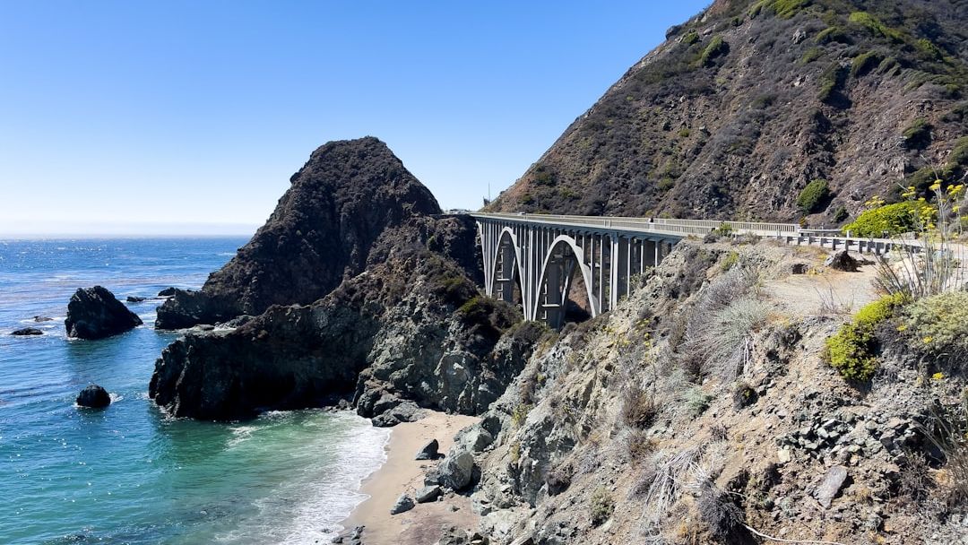
Pacific Coast Highway Through Big Sur, California
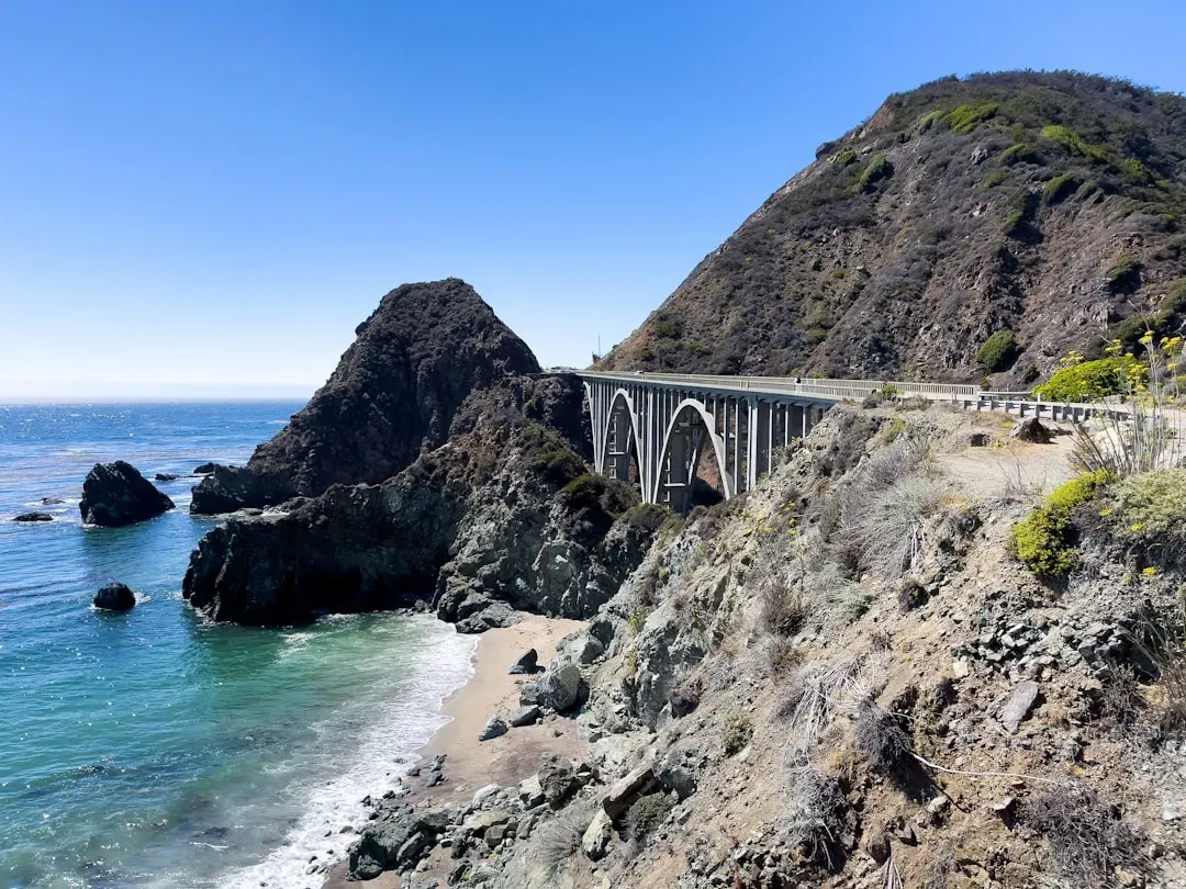
A stretch of Highway 1 winds precariously along sheer cliffs in Big Sur, where drivers gaze at turquoise waters far below. Landslides and erosion have closed this section multiple times, including a three-year shutdown starting in early 2023 that only lifted in January 2026.[3][4] Caltrans battles constant instability, worsened by heavier rains and sea level rise.
Recent reports highlight how climate change intensifies these forces, with more collapses expected as the road clings to eroding bluffs. Parts have already tumbled into the Pacific, and experts question long-term viability without inland relocation.[5] By 2030, frequent closures could make the full scenic drive a relic of the past.
Outer Banks Highway 12, North Carolina
Highway 12 traces the fragile barrier islands of the Outer Banks, linking lighthouses, dunes, and wild beaches perfect for a windswept adventure. Ocean overwash and erosion force regular closures, like those in October 2025 from a powerful coastal storm that shut sections near the Basnight Bridge and Rodanthe.[6][7] Even minor events now breach the road, costing millions in fixes each time.
Studies model worsening threats from sea level rise and storms, with the route increasingly compromised. Local officials note disruptions to communities and tourism, as sand and water claim more ground yearly. Projections suggest sustained access may prove impossible by decade’s end without major redesigns.[8]
The narrow path leaves little room for retreat, turning a beloved coastal cruise into a gamble with every tide.
Overseas Highway to the Florida Keys
US 1 Overseas Highway leaps across turquoise bays from mainland Florida to Key West, a 113-mile chain of bridges evoking island paradise. Much of the Keys sits under five feet above sea level, making the route highly exposed to rising waters and erosion.[9] Projections forecast 10 to 17 inches of sea level rise by 2040, already straining infrastructure.
Flooding tides regularly inundate sections, with climate models predicting chronic high-water events. Monroe County plans for resiliency, but the low-lying spans face existential risks as erosion undercuts approaches. By 2030, the uninterrupted drive could vanish amid submerged causeways and barriers.[10]
Louisiana Highway 1 to Grand Isle
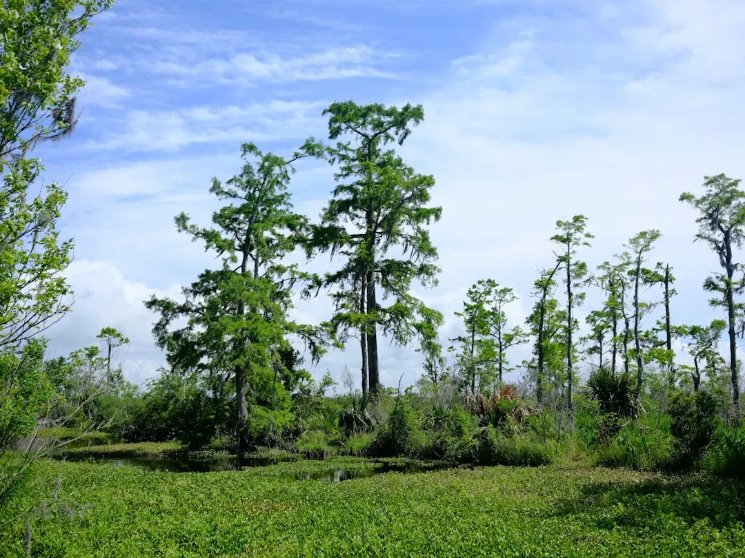
LA Highway 1 stretches through vanishing wetlands to Grand Isle, offering glimpses of shrimp boats and bird-filled marshes on a true bayou road trip. The region loses land at rates equivalent to a football field every two hours, driven by subsidence, erosion, and sea level rise.[11][12] The highway itself dips perilously low, flooded often by surges.
Coastal master plans acknowledge subsidence amplifying erosion, with roads among the first casualties. Recent projects aim to rebuild wetlands, but land loss outpaces efforts. Continued trends point to the route becoming impassable by 2030, severing access to this fading coastline.[13]
San Francisco’s Great Highway and Pacifica Coast Drive
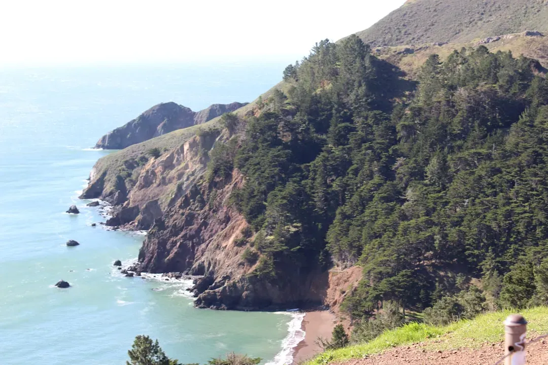
The Great Highway parallels Ocean Beach in San Francisco, extending into Pacifica’s rugged coast for a foggy, wave-pounded drive. Erosion has accelerated here due to sea level rise, prompting partial closures and debates over permanent changes.[1] Waves now chew at the pavement, especially during king tides.
City plans weigh converting parts to trails as the road proves unsustainable, mirroring broader California coastal vulnerabilities. Nearby sections of Highway 1 face similar fates from collapsing bluffs. These local gems risk fading entirely by 2030, lost to an advancing Pacific.[14]
Recent modeling underscores how compound effects will overwhelm defenses along urban edges.
What Lies Ahead for Coastal Drives
America’s coastal roads embody freedom, but nature reclaims what humans build on borrowed time. Repairs buy years, yet escalating erosion and a foot or more of sea level rise by mid-century demand rethinking.[15] Inland reroutes or managed retreats emerge as options, preserving views if not the original paths.
Travelers cherish these trips now, while planners scramble. The lesson rings clear: some horizons shift faster than our maps allow.